The Gritstone Trail
The Gritstone Trail is a long-distance footpath of around 35 miles, which is split into three stages and encompasses some of the finest scenery in Cheshire.
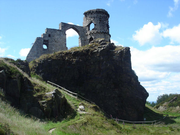
Teggs Nose Country Park
Stage 1 Disley- Tegg's Nose
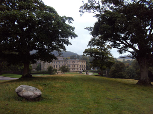
The first stage, covering 10.3 miles (17 km) , leads from the village of Disley (OS Grid ref:- SJ971845) and passes through the Lyme Park estate on the edge of the Peak District. The Trail enters the Park via the East Gate and passes the hall, before rising up to the moors and providing excellent views of the Cheshire Plain. Lyme Park was given to the National Trust by the Third Lord Newton in 1942, to ensure the future of Lyme Park and the estate.The red deer which roam the estate, possibly descend from the ancient herd which once roamed Macclesfield Forest.
Lyme Park
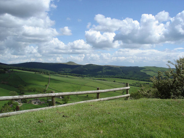
A steep climb leads up to White Nancy, overlooking the town of Bollington, the famous landmark built in 1820 by the Gaskills to commemorate the Battle of Waterloo. The trail goes on to the narrow ridge of Kerridge, passing through remnants of natural oak woodland to Tegg's Nose. from where there are superb views over Macclesfield Forest. On a clear day it is possible to see as far as Liverpool.
Stage 2 Tegg's Nose- Timbersbrook
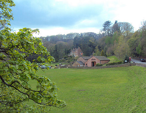
The second stage, 15.3 miles (25 km) long, from Tegg's Nose to Timbersbrook, is the best for obtaining a close look at gritstone scenery. From Tegg's Nose the trail descends into woodland passing Bottom's and Tegg's Nose reservoirs which were built in 1850 and 1871 respectively. They helped provide a steady flow of water down the River Bollin, to power the mills of Macclesfield. Croker Hill, topped with the distinctive telecommunications tower, is the most exposed section of the route. Five standing stones are situated on the trail near the village of Wincle. Three of these are understood to be prehistoric with two more recent additions.
The Peak District village of Wincle
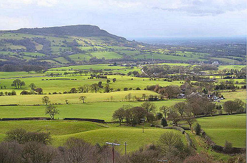
The Trail crosses the River Dane at Barleigh Ford Bridge and then follows the canal feeder before making a steep ascent through Raven's Clough, to the summit of The Cloud (343m). Fine views of the Cheshire Plain and the mountains of Wales may be had from the summit. Not far from the trig point and toposcope at the highest point is a possible prehistoric standing stone.
Bosley Cloud
Stage 3 Timbersbrook-Kidsgrove
The final stage of 9.3 miles (15 km) runs from Timbersbrook to Kidsgrove. From the Timbersbrook Picnic Area it crosses several fields to join the Biddulph Valley Way. The final ridge walk of the Trail follows part of Congleton Edge. The folly of Mow Cop is another distinctive landmark on the Gritstone Trail, perched dramatically on an outcrop of millstone grit. It was built in 1754 by Squire Wilbraham to improve the view from Rode Hall. It sits on the border of two counties, being partly in Staffordshire and partly in Cheshire. The Trail finishes at Kidsgrove railway station. OS Grid ref:- SJ837544)
Mow Cop
The trail is waymarked with yellow discs with a footprint marked 'G'.
Follow the Country Code
*Be safe- plan ahead and follow any signs.
Protect plants and animals and take your litter home.
Keep dogs under close control
Leave gates and property as you found them