Teg's Nose Country Park
Tegg's Nose Country Park a winner of the Green Flag Award, lies on the border of Cheshire and Derbyshire's stunning Peak District.
Originally known as "Tegge's Naze", "Tegge" might have been the name of an early Norse settler, while "nose" probably refers to the southern promontory. The park is situated in what was once an old Macclesfield quarry, quarrying has taken place at Teggs Nose since the sixteenth century and continued until 1955. Some of the old quarrying machinery can still be seen lying about the area, including a jaw crusher used to crush the quarried rock into smaller pieces. The park is now used for recreation. The area consists of open heather moorland, meadows and woodlands and offers very good walks, with superb views over Macclesfield Forest.
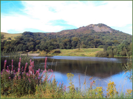
Tegg's Nose Reservoir and Macclesfield Forest from the Country Park
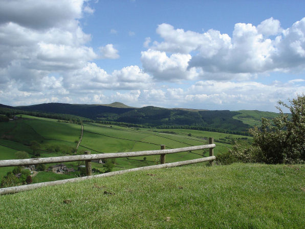
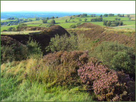
There is a waymarked trail around the park, known as Tegg's trail. A short walk to Tegg's Nose Summit, at a height of 380m or 1246ft, offers stunning views across the Cheshire Plain and across to the summit of Shutlingsloe which is the second highest point in Cheshire as well as the Telecoms Tower on Sutton Common, the Macclesfield Canal and Jodrell Bank. On clear days it is possible to see as far as the Welsh Hills and the Liverpool cathedrals across the Cheshire plain.
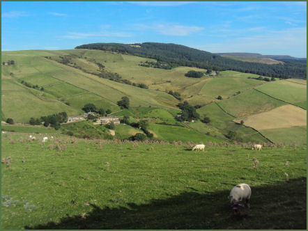
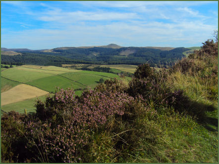
Some of the views from Tegg's Nose Summit
There are two reservoirs in the Country Park, which are Bottoms Reservoir built in 1850 and the smaller Teggs Nose Reservoir constructed slightly later in 1871. They were constructed to supply the nearby village of Langley.
Visitor centre, picnic areas and orienteering
Tegg's Nose Country Park Trail
Distance - 2.5 miles
*Commencing from from the Visitors Centre and car park off Old Buxton Road, head back towards the entrance to the country park and turn left to follow the path which forms part of the Gritsone Trail. After a short distance pass through a stile and turn left and proceed on uphill towards the old quarry and the quarry equipment display, before you reach the quarry area there are good views to your left looking across towards Macclesfield Forest.
*Continue along the path heading south and after a short distance you will reach the summit of Tegg's Nose at a height of 380 metres. Follow the path as it loops back towards the north and look for a path on the left which you then follow downhill towards Tegg's Nose Reservoir.
*On arriving at the reservoir walk along the dam before turning left alongside the reservoir and then alongside Walker Barn Stream towards the north. Carry on along this path until you reach Clough House Farm and bear left and uphill along Saddlers Way which will take you back to the Visitor Centre.
Follow the Country Code
*Be safe- plan ahead and follow any signs.
Protect plants and animals and take your litter home.
Keep dogs under close control
Leave gates and property as you found them