Tarvin
OS Grid ref:- SJ491669
The historic town of Tarvin lies around 6 miles to the north east of Chester, the name is said to derive from the Latin word for terminus although some sources indicate that Tarvin has its origin in the Welsh word tervyn, which means boundary.
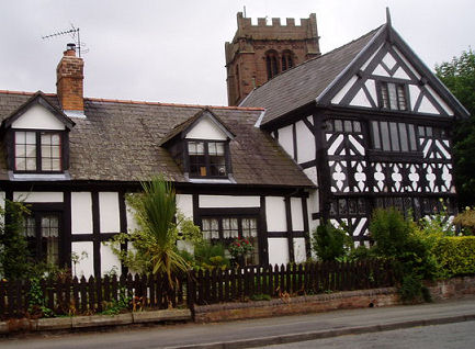
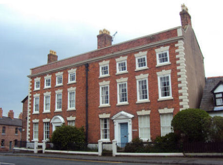
The centre of Tarvin is a Conservation Area with several listed buildings. The township has two very fine half-timbered Tudor cottages and many fine Georgian buildings. The centre of the township was badly damaged during a diastrous fire in 1752 and some Georgian houses were built as replacements. Church House, adjacent to the church, was fully restored in the 1980s. The Old Grammar School was founded by a London merchant in the early seventeenth century.
The church of St. Andrew is built of warm, red sandstone. The original church on the site, probably a wooden structure, was constructed in the twelfth century and was remodelled in the fourteenth century, the south wall and south arcade date from this time. The remainder of the church dates to the fifteenth century.
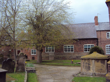
The Old Grammar School
The nave roof is arch-brace and hammerbeam in design and is dated 1650. It was covered in lath and plaster during the eighteenth century, its structure was uncovered again in a restoration in 1891. At the entrance to the Bruen chapel is a fourteenth century wooden screen, the chapel contains a memorial to the Puritan John Bruen (1560 1625), celebrated in his time for his piety. The octagonal shaped font dates to the fifteenth century.
St. Andrew's Church
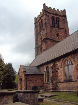
A Saxon cross dating to the eleventh century has also been unearthed in Tarvin. The cross was unearthed in a Civil War trench and was probably broken up before the assault of Chester in 1645. Tarvin changed hands several times during the Civil War. It was attacked by Royalist forces in 1644. In September of the same year the Royalists succeeded in taking Tarvin but it was recaptured by Parliamentary forces in May 1645. St Andrews church still bears the scars of these encounters, cannon ball and musket ball holes dating from this time can be seen in the wall of the church tower next to the west door. It has been said that prisoners were shot against this wall. A grave containing several bodies, identified as civil war soldiers, was excavated and it has been suggested that these were the victims of a skirmish around the church.
Hockenhull Platts
The area is known for it's supposedly Roman Bridges , which are situated at Hockenhull Platts about 1½ miles from the centre of Tarvin, they are in fact mediaeval pack horse bridges over the River Gowy although Roman bridges once previously occupied the spot. The Black Princes Register of 1353 refers to a grant of 20 shillings for the repair of the bridge of Hockenhull.
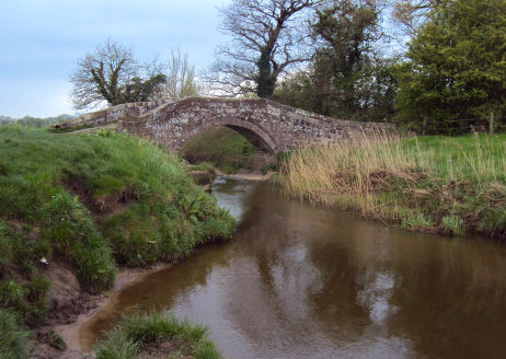
The bridges now form part of Hockenhull Platts Nature Reserve, which consists of a water meadow, a poplar plantation, a pond and reed beds. The area, covering 11 acres, is rich in plant and animal life. The bridges are situated not far from the Welsh border and their name probably derived from a combination of English and Welsh roots. Platt is an Old English word for "bridge" and is associated with "plank". "Hock" may come from the Welsh hocan which means to peddle or to sell abroad. Hen is Welsh for "old" and hoel means a paved way or road. It is therefore possible that Hockenhull Platts means "the bridges on the old peddlars' way"
The Romans founded the fort of Deva at Chester in a round 76 AD and constructed a road, Watling Street, from Chester to York which runs east/west a few hundred yards north of the main village street. Evidence exists of a Roman presence at Tarvin in the form of a Roman coin of Constantius 1 (AD 293305) which was found in the area and other finds in other nearby villages. Recently the remains of a building in a Tarvin field has been identified as a structure associated with roman villa farms.
Nearby Hockenhull Hall, a grade II listed building, dates from the sevententh century but was completely remodelled about 1715 for Hugh Wishaw of Chester.
A walk from Tarvin to Hockenhull Platts
Distance - around 2 and a half miles
Duration- around an hour
*From Tarvin centre take the A51 west and turn left at the brown sign for 'Walk Mill'. Then take the 1st right into Broomheath Lane and find parking near the junction with Platts Lane.
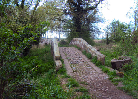
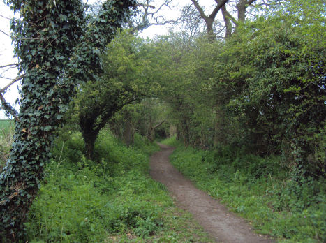
*Continue on foot along the track leading opposite, i.e. leading directly away from Platts Lane. On reaching a junction of tracks continue staraight ahead following the narrower track.
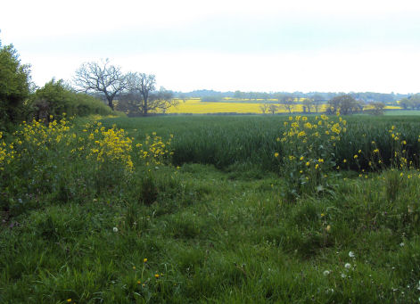
This is actually the old packhorse route, originally formed part of the originally formed part of the medieval road from London to Holyhead. Goods were once carried along here by convoys of packhorses led by a driver, or jagger, walking in front. The route offers fine views across the Cheshire Plain to Beeston Castle and the Peckforton Hills in the distance.
*Follow the track to arrive at the first of the bridges and cross the River Gowy at the central bridge.
Retrace your steps to return.
Nearby places of interest
Chester, historic city founded by the Romans.
Eaton Hall, the country house of the Duke and Duchess of Westminster, is situated just outside the village. The hall has been the home of the Grosvenor family since the 15th century. To the north of the hall is Eaton Chapel, with its handsome clock tower, which is a Grade I listed building. The house is surrounded by formal gardens, parkland, farmland and woodland. The gardens at Eaton Hall draw thousands of visitors each year. The gardens are only open to the public three times a year to raise funds for charity.