Peckforton Hills
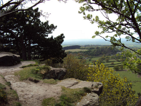
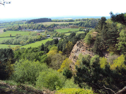
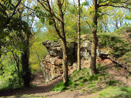
The scenic Peckforton Hills consist of a triassic, sandstone ridge running northeast-southwest across the Cheshire Plain. They form a significant part of the longer Mid Cheshire Ridge. Rugged sandstone outcrops, lofty trees and panoramic views both east and west across a patchwork landscape, combine to create an invigorating walk.
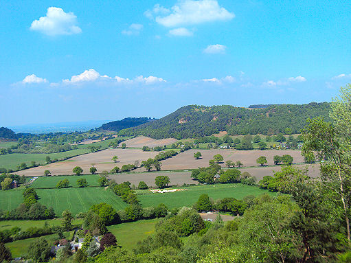
Bulkeley Hill (grid reference SJ525552) stands at the south end and ll has been designated a county site of biological importance for its woodland and grassland habitats. The ridge is continued southwards by Bickerton Hill. The high points are Peckforton Point (SJ529557; 203 m), immediately north of Bulkeley Hill, and Stanner Nab (SJ531573; 200 m), towards the northern end of the ridge. There is evidence of settlement on the hills dating from the neolithic or Bronze Age. The earthworks of an Iron Age hill fort, Maiden Castle, are located on the summit of the southerly hill.
The summit of the northerly hill, Raw Head (OS grid ref- SJ508548), has an elevation of 227 metres and is the highest point on the Mid Cheshire Ridge. Mad Allen's Hole, a cave on the southerly Bickerton Hill, is believed by some to be the location of "Allenscomb's Cave" in which John Harris, "the English Hermit", an eighteenth century eccentric, lived for 46 years.
The Sandstone Trail long-distance footpath runs directly along the ridge. Part of Peckforton Woods has been designated a Site of Special Scientific Interest. Bulkeley Hill is owned by the National Trust, its wooded slopes include 12 acres (5 hectares) of semi-natural ancient woodland.
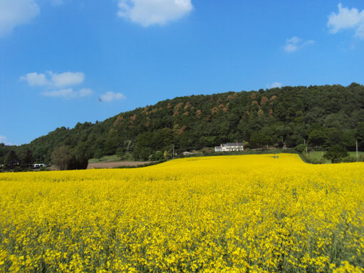
Peckforton Castle, a Victorian mansion built in the style of a medieval castle, stands at the northern end of the Peckforton ridge.
A walk on the Peckforton Hills from Beeston Castle
Distance -8 miles
*Commencing at the car park by Beeston Castle, turn left on exiting the carpark and follow the signs for the Sandstone Trail. On arriving at waymarker 3, follow the castle wall and continue along the trail through the wood. Descend to the road, and cross the stile across the road. Cross a further stile, then a stream and follow the edge of the field.
*On reaching a signpost, turn right crossing a field. On reaching the cottages, turn right on to a lane. Continue down the lane, turn left and follow trail markers. On reaching a junction, continue straight on then follow the trail to left, then right. Turn left on to lane, and then turn left again.
*Continue to follow the trail signs, turn right through a gate then left on to lane. Turn right on reaching a sign and follow the trail for around 100 metres, following the trail left up to Bulkeley Hill.
*Cross the hill along the trail to reach some old gates, leave the Sandstone Trail just before the gates. turn left on to the track which follows the edge of the wood. Turn left on reaching a road and continue up the lane to reach Stonehouse Farm. Pass the farm, then follow thetrack on your right.
*Walk diagonally left to the corner of the field, then turn right to enter a lane. Turn left before the gate, and continue around the wood, then turn right into the wood. Continue along this track, then follow the track as it crosses fields. Cross a stile, then follow path to reach a further stile. Cross into the next field and continue along the path following the markers.
*At the far end of woods turn right on to a track, pass to the left of the green building into a lane, then turn left. Continue straight on at the junction to Haycroft Farm and Campsite. the path passes through a farm, follow the left side of the field to a stile. Join the lane, then take the path on your right to the road. Turn right.
*After passing a cottage, take the path to the left around it. Follow the path across the fields to Beeston village. Turn right on reaching the road which leads into the village and follow the brown signs to return to the car park.
Follow the Country Code
*Be safe- plan ahead and follow any signs.
Protect plants and animals and take your litter home.
Keep dogs under close control
Leave gates and property as you found them