Shutlingsloe
OS Grid ref:- SJ976695
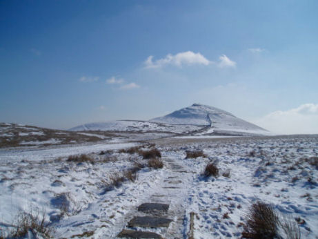
Often referred to as the 'Matterhorn of Cheshire', due to its distinctive triangular profile, Shutlingsloe is situated near the village of Wildboarclough, to the south of Macclesfield Forest, on the edge of the Peak District National Park.
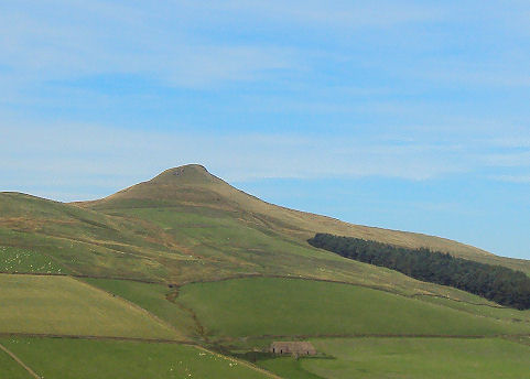
Shutlingsloe is the third highest peak in the Cheshire (Shining Tor being the highest and Whetstone Ridge the second ) with an elevation of 506 metres (1,660 feet), the summit offers excellent views. On a clear day the mountains of North Wales are visible from its summit.
Shutlingsloe- copyright Ian Warburton
The name derives from old English 'Scyttel's hlaw' which translates as 'Scyttel's hill' and is one of several 'low' names in the Peak District, from the same Old English root that gives rise to the name "Law" for many hills in southern Scotland.
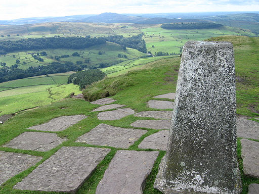
The view from the summit trig point- copyright Chris Wimbush
A walk to Shutlingsloe from Wildboarclough
Distance- around 5 miles (8km)
Duration- about 2 hours
*Commencing at the car park at Vicarage Quarry in the village of Wildboarclough, turn left and follow the road. On passing Dingers Hollow Farm, cross a stile on your left following the track across the hill. On reaching the stream turn left to a stile by a gate. Cross the lane and then a stile stile. Follow the steep route above large oak and ash trees. Continue along the route to a stile to enter a further lane. Turn right at the junction.
* Turn left, entering a lane signed 'Macclesfield Forest Chapel', cross the hill and descend, passing the chapel. Continue along the road for around 250yds to a dip. At the corner of a wood turn left onto a footpath which descends the hill. At the bottom of the hill, near a dam, follow the footpath on your right, crossing a small bridge.
*On reaching a gate, turn left, go down steps the steps to a stile and road. Cross the road to a gap in the wall opposite. The path at this point runs parallel to the road, when it rejoins the road via a gate, bear left onto a wider path, then swinging back right. Go up the steps on the left and sharply back left onto a path rising alongside a stone wall. Where the path becomes less steep, by a kissing gate, bear left onto the footpath. On reaching the next junction, after about 300 yards, turn right to reach another kissing gate. Continue along the gritstone slab footpath across the moors which leads directly to the trig point at the summit of Shtlingsloe.
*Retrace your steps to return.
Follow the Country Code
*Be safe- plan ahead and follow any signs.
Protect plants and animals and take your litter home.
Keep dogs under close control
Leave gates and property as you found them