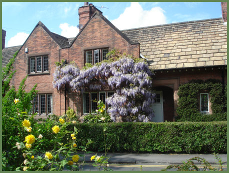
Walton
The small but characterful village of Walton is situated to the south west of Warrington and lies on the Bridgewater Canal. The village is divided into Lower Walton and Higher Walton. The name Walton derives from the tun (settlement/farmstead) of Wealas - which name (meaning foreigner and from which Wales also derives) the Anglo-Saxon invaders used to refer to the native Celts.
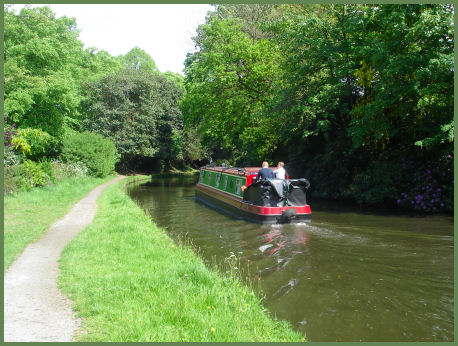
The Bridgewater Canal was constructed to transport coal from the Duke of Bridgewater's mine at Worsley near Manchester. Coal was needed in large quantities to fuel the industrial revolution, the canal enabled coal and other goods to be transported efficiently and cheaply to the rapidly expanding towns and cities. The 65km (39 mile) broad beam canal is the strategic link between the North and South canal network stretching from Runcorn to Leigh.
The Bridgewater canal at Walton
The village pub, the Walton Arms, which offers very good meals, dates from the 1880's.
Walton Hall Gardens
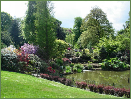
Walton Hall Gardens, previously owned by the famous Greenall brewing family, was purchased by Warrington Borough Council in 1941 and is now a highly attractive park and golf course. The hall dates from the 1830's although built in Elizabethan style. It was designed by the Gothic revival architect Edmund Sharpe. The Gardens, which have been open to the public since 1945, have spacious lawns, picnic areas, a well appointed play area, a children's zoo containing a variety of colourful birds and animals and an interesting heritage centre which covers natural history, the history of the Walton Estate and Greenall family and Lewis Carroll and his connections with Walton Hall.
A country walk from Walton
Length:- around two and a half miles
Duration:-about one and a half hours
Commencing at the car park at Walton Hall Gardens, coss the bridge over the canal and proceed to the hall. To the side of the hall, turn left across the lawns in the direction of the trees behind the bowling greens.
Go through the pinchgap and folllow the path until it reaches the road. Turn right and go up the hill to the reservoir. Turn right into Park Lane, then left, following the steps to the path which borders the Appleton Reservoir.
Continue along this path around the edge of the reservoir and turn right back onto Park Lane, passing Daintith Farm. Turn off at the second path on the left and follow the path up to Hill Cliffe around the edge of the wood.
When a junction in the path is reached, take the path alongside the cemetery. At the road near the cemetery entrance turn left down Red Lane.
At the base of the hill turn left before the canal bridge down the signposted bridleway. Just before reaching the entrance to a farm turn right down the steps and proceed along the path tot the canal.
Turn left along the path to the bridge, cross the bridge and turn right, joining the towpath, continue on the towpath until reaching another bridge, at this point ascend the steps back up to the Walton Hall Gardens car park.