Tissington Trail
 The Tissington Trail bridleway and walk/cycle path was opened in 1971, and now forms part of the National Cycle Network.
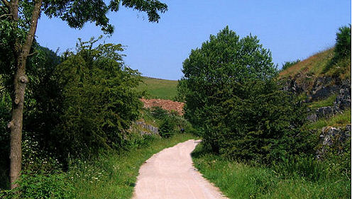
The linear trail runs for 13 miles (21 km) from the village of Parsley Hay (53.1706°N 1.7828°W) in the north to the town of Ashbourne (53.0196°N 1.7397°W) in the south, along part of the trackbed of the former railway line connecting Ashbourne to Buxton.
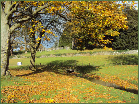
The trail derives its name from the highly attractive village of Tissington, (pictured below left), one of the most picturesque villages in England, which it skirts. It is joined by the High Peak Trail at the small village of Parsley Hay.
The elevated trail (at Parsley Hay it is over 1,000 feet (305 m) high and offers excellent Peak District views, with stunning views over the rolling green dales of the White Peak around Alsop, it has an easy gradient and firm surface throughout and picnic tables are provided, but on the down side can also be exposed in poor or wet weather.
 Hartington signal box, by the trail, has been converted into an Information Centre, it is open in summer on Saturdays, Sundays and Bank Holidays.
There are an abundance of wild flowers and butterflies on the trail in the summer months, including the common blue butterfly and the red admiral.
The National Park Authority provides cycle hire at both ends of the Trail, i.e. at Parsley Hay and Ashbourne. From Hartington station northwards, the route is also part of the Pennine Bridleway, a 130-mile (209 km) trail which includes 73 miles (117 km) through Derbyshire to the South Pennines. The Bridleway has two southern starting points, the other being at Middleton Top, near Cromford, on the High Peak Trail.
Built by the LNWR, the line opened in 1899, and linked with the Cromford and High Peak Railway at Parsley Hay. It was the last railway constructed in the Peak District. Despite the relatively short length of the line, it was highly popular with walkers and ramblers, apart from the elevated views over the Peak District itself, it also passed close to panoramic Dovedale, a dramatic and highly popular limestone ravine..
The line closed to regular passenger traffic in 1954, and all services ceased in October 1963.
Map - OS White Peak 1:25,000 Map
Facilities
 *At Parsley Hay (map ref: SK 146637) there is a car park, toilets, picnic site, visitor information and cycle hire. There is direct level access to the trail.
* At Hartington Station (map ref: SK 149610) there is a car park with toilets and picnic site. There is level access onto the trail.
*At Ruby Wood (map ref: SK 149604) there is a car park and a picnic site.
*At Alsop-en-le-Dale Station (map Ref: SK 155549) there is a car park with picnic site. There is level access onto the trail.
*At Tissington Station (map ref: SK 177520) there is a car park, with toilets and picnic site.
*At Thorpe Station (map ref: SK 165503) there is a small car park and picnic site, with level access onto the trail.
*At Narlows Lane, near Thorpe (map ref: SK 163504) there is a car park.
*At Mapleton Lane, near Ashbourne (map ref: SK 175473) there is a car park, toilets, and cycle hire.
Follow the Country Code
*Be safe- plan ahead and follow any signs.
Protect plants and animals and take your litter home.
Keep dogs under close control
Leave gates and property as you found them