Ogden Reservoirs
OS Grid ref:-
The Upper and Lower Ogden Reservoirs are situated in the shadow of brooding Pendle Hill and lie half a mile to the west of the village of Barley. The reservoirs supply drinking water to the town of Nelson. The larger reservoir, Lower Ogden, was completed in 1914 and has a surface area of 8.55 hectares (21.12 acres). Upper Ogden was completed in 1906 has a surface area of 2.84 hectares (7.014 acres).
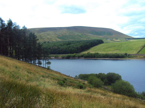
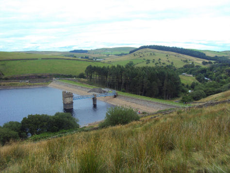
Three forests are situated close to the reservoirs, which cover more than 23 hectares (57 acres). The largest of these, Fell Wood, was planted in 1931 and contains Norway Spruce (Picea abies), Sitka Spruce (Picea sitchensis), Scots Pine (Pinus sylvestris) and European Larch (Larix decidua). Blue Wood, which was originally planted in 1935 with Scots Pine, Sitka Spruce and Larch was felled and replanted in 1981. The third forest: Buttock Plantation, was planted in 1935 with Sitka Spruce and Larch.
Blue tits, coal tits, blackbirds and robins, are often sighted in the woodland, as are redstart and pied flycatcher in the summer months. The goldcrest, is also often sighted, Britain's smallest breeding bird, it weighs only 5 or 6 grams.