Marple
OS grid ref:-
The town of Marple is situated on the border of the Peak District National Park.
There are two possibilities suggested for the derivation of the name Marple, the first being "maere hop hyll" (meaning the hill at the boundary valley) and the second "maere pill" (the stream at the boundary). The area was settled by the Celts, several millennia ago. There are clues of their existence dotted around the Ludworth area, with the Ludworth Standing Stones and the Tumuli, where they buried their dead. Much of this was confirmed around 1998 when an archaeological dig in Mellor revealed many clues about the existence of Marple's earliest residents. The area was predominantly woodland lying within the large Macclesfield Forest, and as such was omitted from the Doomsday survey.
A plaque, close to Marple Hall School marks the site of the former Marple Hall, built by the Vernon family of Haddon Hall during the reign of King Henry VII and later passed into the hands of the Stanleys. The hall has sadly been demolished. The old hall foundations can still be seen on the corner of Marple Hall Drive.
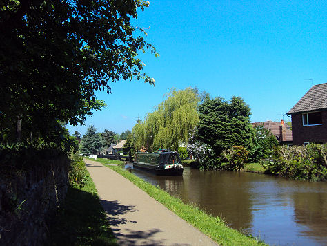
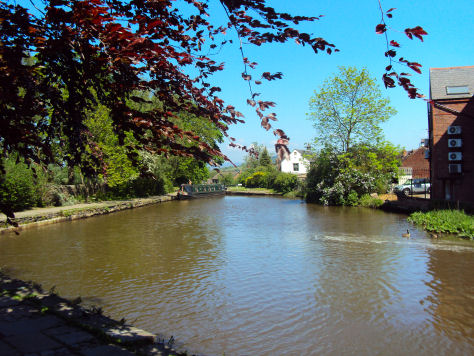
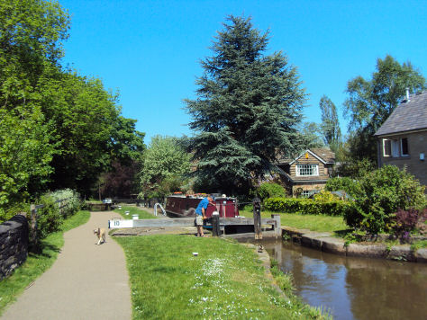
The town stands on the site of a major intersection of the Upper and Lower Peak Forest Canals with the Macclesfield Canal and has an important British Waterways Depot Yard on the junction, with a nearby flight of 16 picturesque locks leading down to Portland Basin in Ashton-under-Lyne. The canal circles around the outskirts of the village, alongside both Marple Memorial Park and then along Brabyns Park until it reaches the Marple Aqueduct and onwards along the Peak Forest Canal. The canal served as a vital link for the village during the industrial revolution and is to be thanked for the sustained population in the area. Nowadays it provides an area of relaxation for walkers, anglers and boaters. The area is abundant with wildlife.
The Roman Lakes leisure complex at Marple is highly popular with walkers, anglers and horse riders. It is situated in the valley bottom close to Strines. The picturesque Roman Bridge which spans the river is a packhorse bridge dating back to the 1700's. The area is a beautiful undisturbed natural landscape, with rich pastures, a flowing river and spectacular surroundings.
The area closest to the river was once a mill built by Samuel Oldknow, it is now ruined and overgrown.
Nearby places of interest
Lyme Park is situated in a spectacular moorland setting at Disley near Stockport on the edge of the Peak District National Park. The house and surrounding estate are owned by the National Trust. The lavishly decorated Italianate house has spectacular seventeen acre gardens, which include the Victorian Garden and Edwardian rose garden.
Mellor Iron Age Fort Iron Age settlement discovered in the 1990's, occupied from the Bronze Age to the Romano-British period, featuring a reconstructed Iron Age roundhouse.
Dunge Valley Gardens are situated just to the west of Windgather Rocks and are well worth a visit, especially in April and May when the rhododendron's are in bloom.