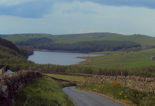
Lamaload Resevoir
OS grid ref:- SJ972750
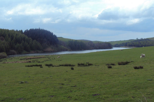
Lamaload Reservoir lies to the west of the Goyt Valley in the Peak District National Park. The reservoir is fed by the River Dean and provides a supply of water to the nearby town of Macclesfield. The reservoir, which is is approximately 1,000ft (308m) above sea level, it is the highest constructed dam in England. The reservoir was built between 1958 and 1964. The surrounding landscape consists of moorland with plantations of larch and pine.
Among the most popular locations for tourists in the South West Peak, Lamaload is used for fishing and birdwatching, and also forms an important access point for walkers to the surrounding moorland. Shining Tor, known as the Cheshire Matterhorn, because of its distinctive triangular shape lies within a few miles. The peak is the highest point in Cheshire.
A walk from Lamaload Reservoir to Windgather Rocks
Distance around 10 miles
*Commencing at the car park at Lamaload Reservoir, exit through the gate to the reservoir and turn right along the track. On reaching the buildings at the bottom of the dam turn and continue in a north westerly direction to reach a small farm. Continue up the drive to a track junction and turn right, pass through a further farm to arrive at Ewrin Lane. Turn left on this lane and right at the next lane and continue down.
 *On reaching the point where the track turns right, cross a stile on the left. Continue along the track and cross a stile, take the track which descends, following the broken wall down to Summer Close. Pass through 2 gates and take the left track. Cross the fields, heading north, to a gate in the fence. Ascend the hill, passing a ruined building.
Still climbing gradually, on reaching the stile to Charles Head Farm, continue up the lane to the farm, turn right passing to the left of the woodshed crossing over a further stile into a lane. Proceed down the lane, cross a stile and turn right, following the farm track to the road.
*Turn right and follow the road towards Kettleshulme. On reaching cottages on the left, turn right crossing the stile opposite. On reaching a lane turn left and cross the road following the footpath to reach a further road. Cross over this road continuing up the path to Taxal Edge. Do not turn right here but continue climbing up to the high ground ahead.
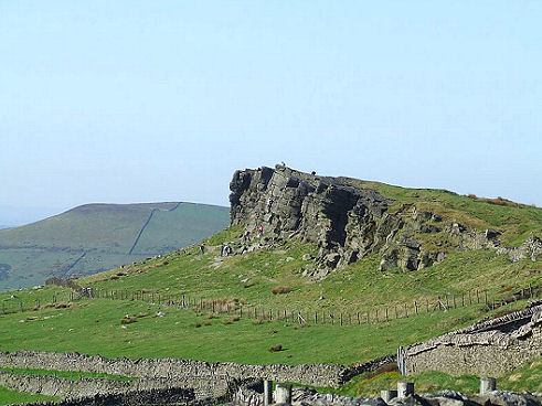
* On reaching the ridge turn right. The ridge path drops down joining a path from the left, turn right descend to a stream in the woods then climb up the other side of the stream to a wall. Turn left and keeping to the wall you will reach the top of Windgather Rocks.
*The track heads south climbing rocks and continues alongside the road to a T-junction. Turn right down the road and follow the first signed footpath on your left Continue along on this track to arrive at a farm, go down to the stream, cross a stile and climb up towards a path descending from Shining Tor. On reaching this track turn right following walls and fences at first uphill then down to the road overlooking the Reservoir. Turn right on this road back to return to the car park
Follow the Country Code
*Be safe- plan ahead and follow any signs.
Protect plants and animals and take your litter home.
Keep dogs under close control
Leave gates and property as you found them