Foolow
OS Grid ref:- SK191768
 The picture postcard village of Foolow, situated 2 miles to west of the plague village of Eyam, is described in the Peak Park Tourist Guide as being one of the prettiest villages in the Peak.
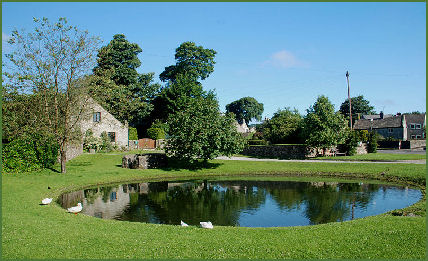
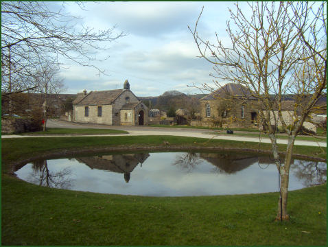
The village has an interesting array of distinctive grey-limestone dwellings clustered around its attractive village green and duck pond. Foolow was known in medieval times as `Fuwelowe', which means `hill frequented by birds'.
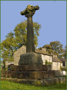
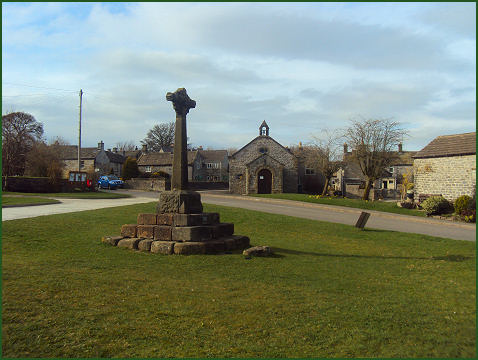
An ornate cross stands on the village green, dating from the fourteenth century, it is inscribed with the date 1868, which commemorates the date when it was moved from the site of the Wesleyan Reform Chapel and its shaft was replaced. It may once have been a marker for the boundary of the Royal Forest of the Peak.
A former bull ring lies in front of the cross, The ring was used to teather bulls while they were attacked by dogs. Bullbaiting was made illegal in England in 1835.
The tiny church of St. Hugh stands near the village pond, it was originally built as a private dwelling early in the nineteenth century. The Wesleyan Reform Church also dates from the nineteenth century. Adjacent to the green is the seventeenth century Old Hall whereas the nearby Manor House dates to the eighteenth century. The ancient custom of Well Dressing was revived in the village in 1983 and takes place in the last week of August.
The Bulls Head by the village green, which has been an inn for at least two centuries, offers fine ales and good food as does the "Barrel" which is situated on Bretton ridge above the village, which boasts views over five counties.
Waterfall Swallet, where one of the local streams disappears underground is situated on the road to Eyam. The Tup Low Bronze Age tumulus lies to the north west of the village, whilst Long Low lies about ½-mile to the northwest and consists of a cairn constructed of limestone blocks set in a circle.
Image 1 courtesy of Rob Bendall
Nearby places of interest
The Longshaw Estate, owned by the National Trust, offers scenic Peak District, views, ancient woodland, parkland and heather moorland.
Peveril Castle, standing majestically on a limestone outcrop at Castleton in the picturesque Hope Valley, Peveril Castle dominates the surrounding landscape. The castle was founded by William Peverel (c. 1040circa. 1115)
Winnats Pass is situated in the High Peak area of the Peak District National Park and lies to the west of the attractive village of Castleton.
Lathkill Dale A Peak District beauty spot in the truest sense of the word, Lathkill Dale is one of Britain's finest limestone valleys
Arbor Low Stone Circle, sometimes referred to as The Stonehenge of the North', a prehistoric site of unique archaeological and cultural interest. The monument is atmospherically set amid high moorland near the town of Bakewell.