Fernilee Reservoir
OS Grid ref:- SK014769
An increased demand for drinking water in the early twentieth century led Stockport Corporation Waterworks to purchase the Goyt Valley for the building of two reservoirs. The farms and houses in the valley were emptied and demolished by the 1930's in order to provide an uncontaminated water catchment area.
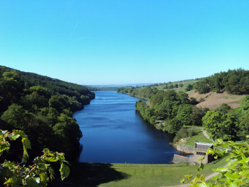
Building on Fernilee Reservoir was completed in 1938. It cost about £480,000 to construct and holds 4940 million litres. The Chilworth Gunpowder factory, believed to date back to the 16th century, now lies beneath the waters of the reservoir. A serious explosion at the factory in 1909 killed three men, but it was still very active during the First World War. The water treatment works below the dam were constructed using stone from the demolished Errwood Hall.
North West Water now own much of the Valley and the surrounding moorland, which is the water catchment area for Fernilee and its neighbouring reservoir, Erwood. Together these two reservoirs supply an average of 7-8 million gallons of water a day, some direct to Whaley Bridge and the rest to the Stockport region.
From the Errwood Reservoir dam the view of the view of the reservoir is magnificent. Common sandpipers and other birds breed along the reservoir banks. The noisy canada geese and mallard are the most common summer residents.
A walk in the Goyt Valley from Fernilee Reservoir
Distance- around 6 miles
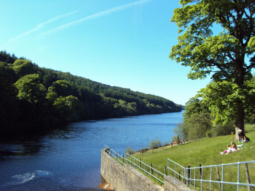
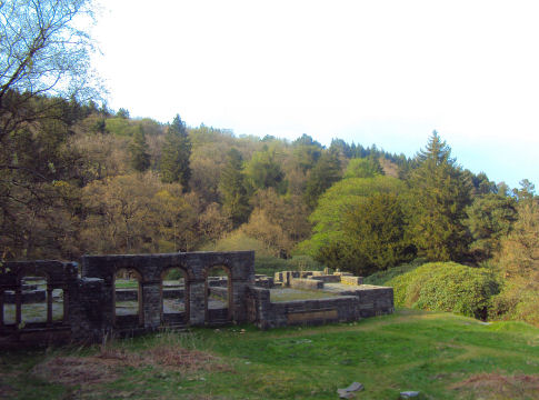
*From the car park opposite the sailing club by the dam which seperates Fernilee and Errwood Reservoirs, take the Forestry Commission nature trail path which climbs up to meet the trees at a gap in the wall. Follow the track up hill to the ruins of Errwood Hall
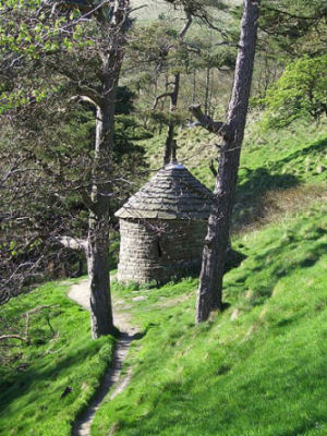
*Follow the woodland track which leads up from the hall until you spot a small, circular building, which is known as the Spanish Shrine, which lies just off the main path.
*Continue up the steeply rising path to meet ta road, then turn left to ascend to the summit of the road at Pym Chair. Turn left at this point and continue along the path beside a wall, across the moor beside the wall, which descends to Oldgate Nick.
*Descend further, down to the col then steadily up again to the summit of Shining Tor, reached by crossing the wall by a ladder stile. At 559m/1,834ft the hill is the is the highest point in the county of Cheshire.
* Turn left back over the wall and descend the track passing the head of Shooter’s Clough, at which point turn left to descend on the ridge above the clough on your left on a track which leads down to the dale road to return to the car park.