Edale
OS Grid ref:-
 The characterful Peak District village of Edale lies in a picturesque setting in the Hope Valley to the south of the moorland plateau of Kinder Scout, which at 2,088 feet (636 metres), is the highest point in the National Park.
Popular with walkers, the village is also situated at the starting point of the Pennine Way.
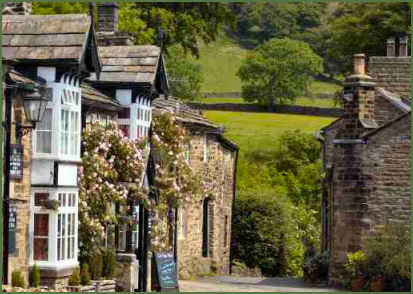
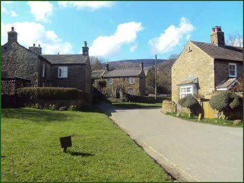
One of the village's two pubs, the stone built Old Nag's Head, (pictured left) is a former smithy and dates back to 1577. The front door marks the start of the Pennine Way.
Both Edale pubs, the Old Nags Head and the Rambler Country House Hotel provide food and accommodation, there is also a youth hostel and a number of bed and breakfast establishments and campsites, a cafe, post office and general store in the village.
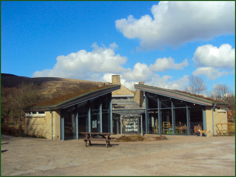
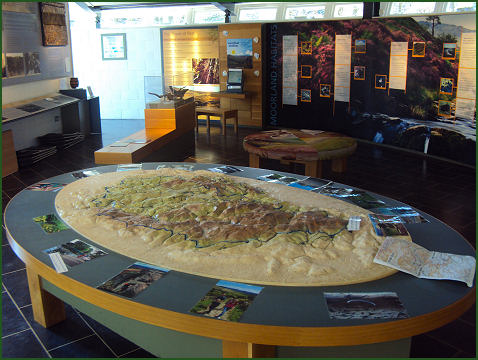
The Edale Visitor Centre, known as 'The Moorland Centre' hosts interactive exhibitions, the impressive centre has a living roof of sedum turf, with a waterfall tumbling over glass panels into a pool at the entrance. It is both a tourist information centre and flagship centre, a national focus for moorland research and an inspirational experience for visitors to the Peak District National Park.
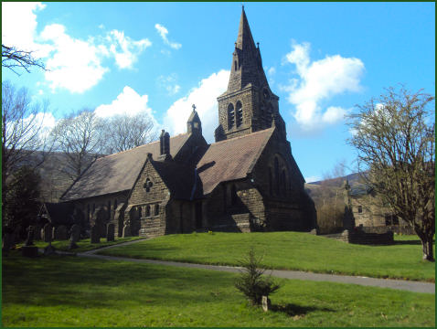
The village church of Holy and Undivided Trinity and was built in 1885-86 to a design by William Dawes of Manchester, the broach spire was added in 1889. It is the third church to occupy the site.
Edale Mill, to the east of Edale village, dates back to the eighteenth century, it was originally built as a corn mill but was later converted to a cotton mill by Nicolas Cresswell. It is now owned by the Landmark Trust and provides holiday accommodation.
The Moorland Centre, Edale
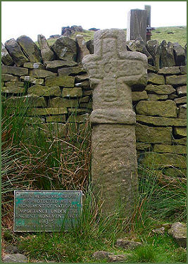
The Edale Cross (pictured above right) is located close to Kinder Low End at the top of the bridleway from Hayfield to Edale at an altitude of 1750 feet. The cross is an ancient monument dating from the medieval period and was probably erected by the Cistercian monks of Basingwerk Abbey to mark the southern boundary of land which they were granted by King Henry II in 1157. The base and part of the shaft are missing. The cross was found buried in peat and re-erected by local farmers in 1810. The farmers initials can be seen inscribed on the cross.
Nearby places of interest
Kinder Scout, a moorland plateau, rising to 636 metres (2,087 ft) which is highest point in the Peak District.
Lyme Park is situated in a spectacular moorland setting at Disley near Stockport on the edge of the Peak District National Park. The house and surrounding estate are owned by the National Trust. The lavishly decorated Italianate house has spectacular seventeen acre gardens, which include the Victorian Garden and Edwardian rose garden.
Mellor Iron Age Fort Iron Age settlement discovered in the 1990's, occupied from the Bronze Age to the Romano-British period, featuring a reconstructed Iron Age roundhouse.
Dunge Valley Gardens are situated just to the west of Windgather Rocks and are well worth a visit, especially in April and May when the rhododendron's are in bloom.