Dunsop Bridge
OS grid ref:-SD6550
The picturesque village of Dunsop Bridge in Lancashire's beautiful Ribble Valley area, is located some 9 miles north-west of the town of Clitheroe and 15 miles (24 km) south-east of the historic city of Lancaster, the village lies at the confluence of the River Dunsop and the River Hodder.
Dunsop Bridge has been declared by the Ordnance Survey as the nearest village to the exact centre of the British Isles. This is recognised by a commemorative public telephone box, which was unveiled by Sir Ranulph Fiennes in 1992. The plaque on the telephone box reads "You are calling from the BT payphone that marks the centre of Great Britain."
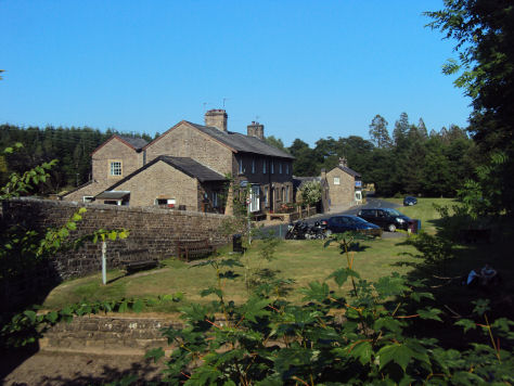
Dunsop Bridge developed into a village in the mid nineteenth century as a result of the lead mining industry in the area. Prior to then the area had only a few isolated houses and farms. Thorneyholme House, near the centre of Dunsop Bridge was once home to John Towneley, 13th Lord of Bowland, up until his death in 1878.
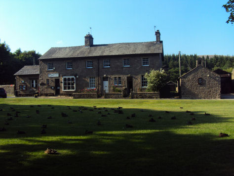
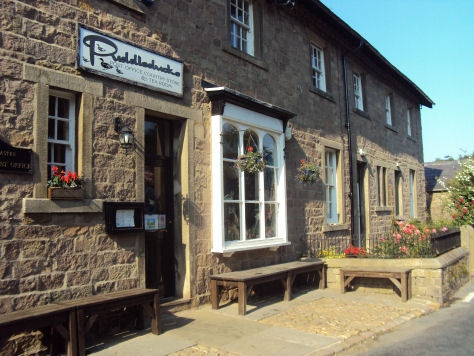
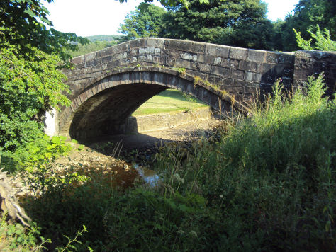
 The picturesque bridge that gives the village its name is a popular place to feed the ducks, the village has a post office which doubles as the village store and Puddleducks Tea Rooms, which serves refreshments.
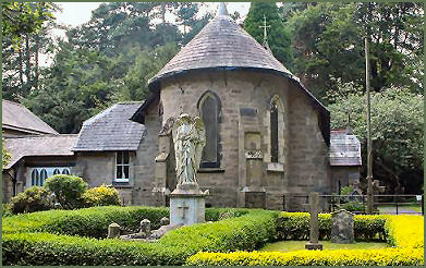
The small Roman Catholic church of St. Huberts (pictured right) was designed by Edward Pugin, son of the famous neo Gothic architect Augustus Pugin and payed for it is said by the winnings of the racehorse Kettledrum owned by Colonel Charles Towneley in the 1861 Epsom Derby.
The horse is commemorated in a painting on the ceiling above the altar. The middle west window depicts St. Hubert who is the patron saint of hunters, as a huntsman accompanied by a stag. The medieval font was brought from the ancient church at Burholme near Whitewell.
The altar stone was hewn at Waddington Fell. In the centre of the altar, lectern and candle stand is the head of St. Huberts stag with the cross between its antlers. The east and west windows were made by J.B.Capronnier of Brussels in 1865. Outside the church is the figure of an angel which stands over the Towneley family vault.
A popular area with walkers, winding paths from the village through the moors to Lancaster are popular with thousands of fell walkers. There are attractive short walks to the nearby rocky outcrop of Whitendale Hanging Stones or Middle Knoll, a mile or so away.
A Walk from Dunsop Bridge to Whitendale
Distance :- around 8 miles
*Commencing at the car park at Dunsop Bridge, exit the car park, pass the petrol station and the post office and before reaching the bridge turn right. Walk along the lane, crossing fields, behind the cottages to reach the River Dunsop. On arriving at the west bank turn right and continue along the road.
*On arriving at a concrete Salmon Ladder, do not cross over the bridge but continue along the road. The road ascends to join a road from coming in from the right. Leave the road at this point and continue along the bridleway that contours across the western side of Middle Knoll.
*On reaching the end of the bridleway at a gate just before a brook, cross a stile on your right. Continue along the path, passing a fenced lake on the left and descend to Whitendale Farm.
*Continue on, to the right of the farm, pass through the farm gate and turn right at the end of the wall to follow the path on the other side of the river to the Salmon Ladder from which point retrace your steps to Dunsop Bridge.
Nearby Places of Interest
Whalley Abbey- founded by Henry de Lacy, third Earl of Lincoln on the 4th April 1296.
Lancaster Castle founded in the tenth century
Ashton Memorial in Williamson Park, Lancaster was commissioned by James Williamson, Baron Ashton as a tribute to his second wife, Jenny and was built between 1907 and 1909.